OsmAnd 4.2 (Android)

Hi, Everybody!
After a long break, we are happy to announce the release of the new version 4.2 OsmAnd app for Android devices. You can already update the app and check out the following long-awaited improvements in this new version of the app.

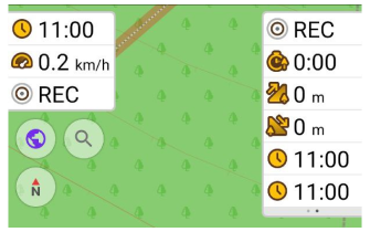
New in OsmAnd Widgets
We've done a lot of work on the widgets and interface of the Configure screen:
- We redesigned the Configure screen, separating the widgets from the buttons, and spacing the different widget panels more clearly.
- Added pages for widgets.
- Duplicates.
- Combined the widgets from the left and right panels: now any widget that was previously only available in the left panel can be added to the right panel.
Pages and Duplicates for widgets
Widgets in the Left panel and Right panel can be grouped into Pages.
OsmAnd menu → Configure screen → Widgets (Left / Right panel) → Change order → Add pages
You can show Duplicates for the right/left panels at the same time, as well as for each page of widgets.
OsmAnd menu → Configure screen → Widgets (Left / Right panel) → Change order → "+" chosen widget
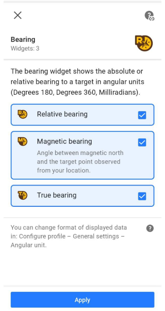
True bearing widget
Added new widgets for "Bearing". Bearing now has 3 separate widgets:
Menu → Configure screen → Widgets → Left / Right panel → Bearing
- Relative bearing is the angle between your forward movement direction and the target point.
- Magnetic bearing is the clockwise (horizontal) angle between the magnetic north and the target point observed from your location.
- True bearing is expressed as the horizontal angle between the geographic meridian and a line on Earth. Specifically, true point bearing is the angle measured in degrees clockwise from the True North line.
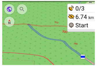
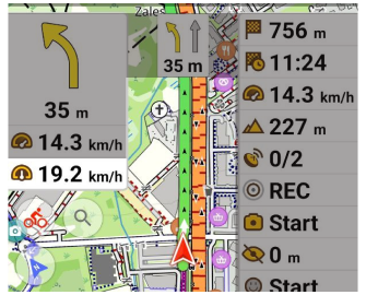
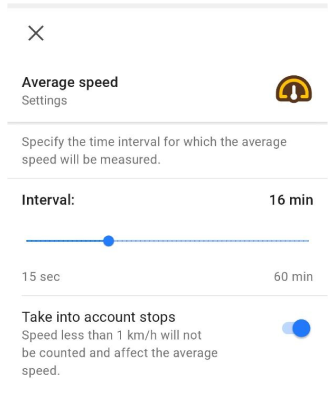
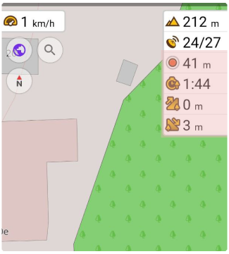
Average speed widget
The new Average speed widget shows the average speed of the current ride:
Menu → Configure screen → Widgets → Left / Right panel → Average speed
The average speed is calculated for the specified time interval. Click on the "Settings" button of the Average Speed widget to select the time interval for which the average speed will be measured:
Menu → Configure screen → Widgets → Left / Right panel → Average speed → ⚙️
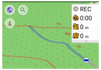
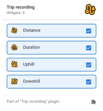
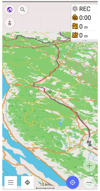
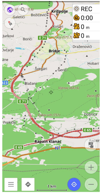
Trip recording widgets
Added new widgets for "Trip recording". Trip recording now consists of 4 separate widgets:
Menu → Configure screen → Widgets → Left / Right panel → Trip recording
- Distance/Start-Stop: starts or stops trip recording and shows distance of the currently recorded trip. Clickable widget.
- Duration: shows the duration in minutes/hours of the currently recorded trip.
- Uphill: shows the sum of all climbs of the current recorded trip.
- Downhill: shows the sum of all descents of the current recorded trip.
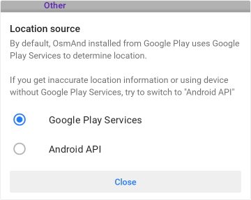
Location provider
You can choose which Google Play or "Android API" services OsmAnd will use to determine your location. This can be useful for devices without Google Play services or in case of inaccurate location or altitude data when recording tracks.
OsmAnd takes data from the resources Google's Fused Location Providers and Android GPS and Network Providers.
You can switch Location source in: Menu → Settings → OsmAnd settings.
2.5D view for testing
View 2.5D is a beta version. It is still in the testing phase.
We've added 2.5D view to OsmAnd for Android. Enable OpenGL rendering to run 2.5D view for the device: OsmAnd menu → Plugins → OsmAnd development → Settings → Use OpenGL rendering.
2.5D rendering has squares rendering type.
"Tilt"gesture makes 2.5D view.
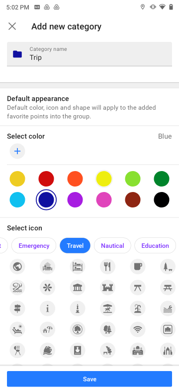
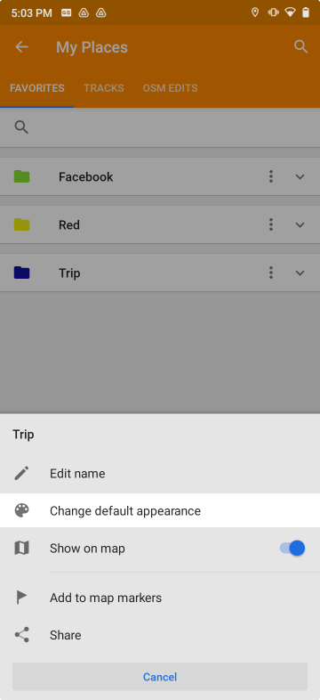
Default appearance for favorites
You can now set the default appearance for new points in Favorites group or change the existing appearance for all favorites points at once.
The appearance can be set when creating a new group or changed for an existing one:
Menu → My Places → Favorites → ⁝ → Change default appearance.
 |  |
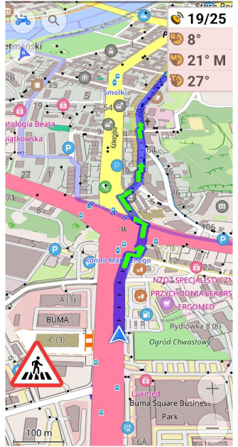
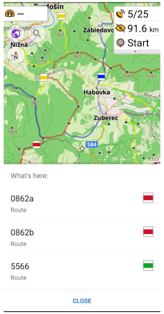
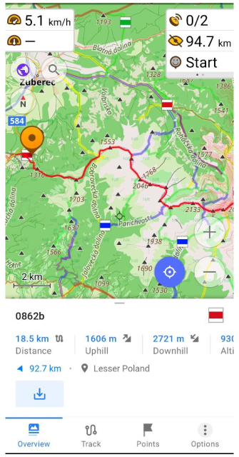
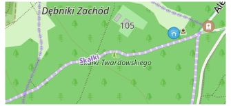
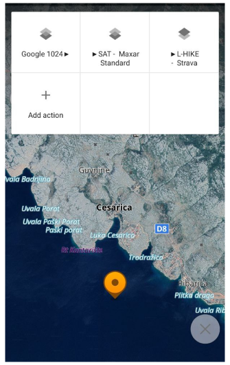
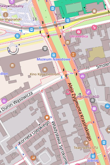
Routes on the map
Selecting a route on the map
Hiking / Cycling / Travel routes: tap the route symbol, get full route information and download the GPX file for the selected route.
Routes are marked on the map with OSMC symbols. In OsmAnd you can show OSMC symbols and routes in Configure map menu.
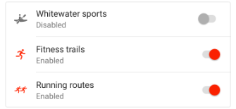
New types of routes
Added display of Fitness trails and running routes to the map. Can be enabled in Configure map → Routes. Data for these routes are taken from the OpenStreetMap project:
- The tag route=fitness_trail
- The tag route=running
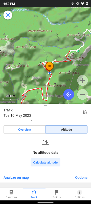
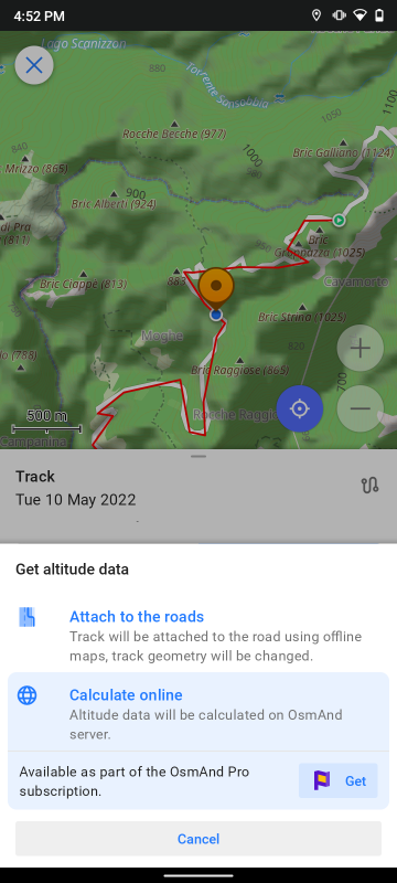
Online Elevation profile
 Online SRTM feature you can use only with Pro feature OsmAnd Pro subscribers.
This feature allows to calculate Elevation profile for GPX track online by the OsmAnd server:
Track Context menu → Track → Altitude → Calculate online
 |  |  |
New actions for GPX tracks
Update Track Context Menu
Track context menu now shows country or region for the track and track waypoints. Overview tab now has an "Info" card with detailed information about the location and file size of the track.
 |  |
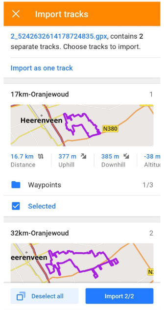
Import Multitrack
Splitting the multitrack file into individual tracks when importing a GPX track. You need to select the tracks to import. The tracks will then be available in:
My Places → Tracks.

New items for "Quick action"
- Added "Plan route" tool to the Quick action menu.
- Overaly/Underlay changes with arrows:
-
Switched off a layer: ➤"Layer name"
-
Switched on a layer: "Layer name"➤
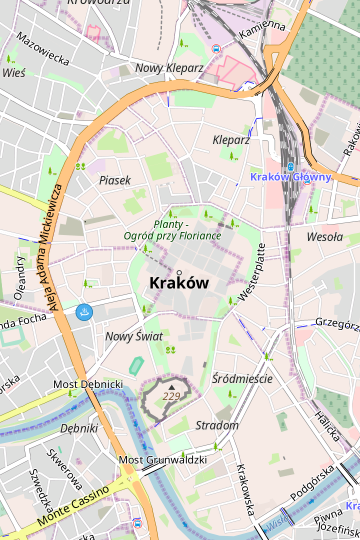
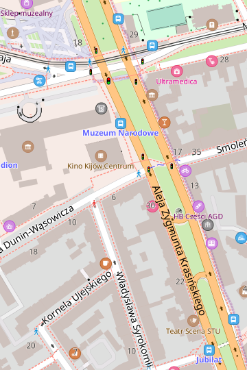
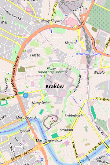
New "Map style"
The Map style "Mapnik" has been replaced by the new style "OSM-Carto". This was done because when "Mapnik" was added to OsmAnd, it was identical to the map style on OpenStreetMap.org, but we had no way to keep it up to date, so over time it lost similarity to the OSM map style.
Using "Mapnik" will be available after the upgrade but as a custom map style. After a fresh or new installation, you will need to import it for use manually. You can do this by downloading it from GitHub.
- OSM-Carto
- Mapnik
 |  |
 |  |
New POIs
New POIs and objects have been added to offline maps in 4.2.
- Added new shops: wool, motorcycle_parts , rice, water_sports, printer_ink, fuel, hairdresser_supply, tiles, collector.
- Added: landuse=greenery, natural=blowhole, natural=anthill, carriage=.
- Support "flow_rate" tag.
- Added new clubs: club_automobile, club_fishing, club_sailing, club_shooting, club_veterans.
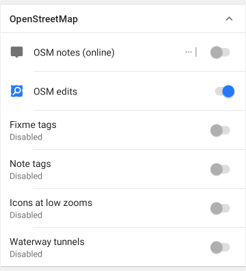
OpenStreetMap Editing menu
- All OpenStreetMap-related items in Configure Map have been combined into one single group. The "OSM Mapper assistant" option has been split into four separate options: Fixme tags, Note tags, Icons at low zooms, MISSING Android resource: rendering_attr_OSMMapperAssistantWaterwayTunnels_name!.
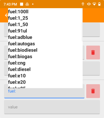
- Fixed tag autocomplete in "Modify POI" mode.
- Fixed incorrect link to the OpenStreetMap object in the context menu.
(no screenshot available)
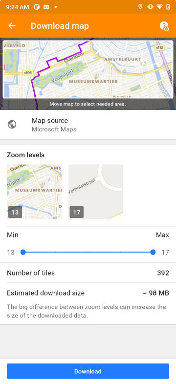
Online maps fixes
- Fixed: automatic update of online tile maps.
- Updated UI for dowloading online tile maps.
 |  |
Other changes
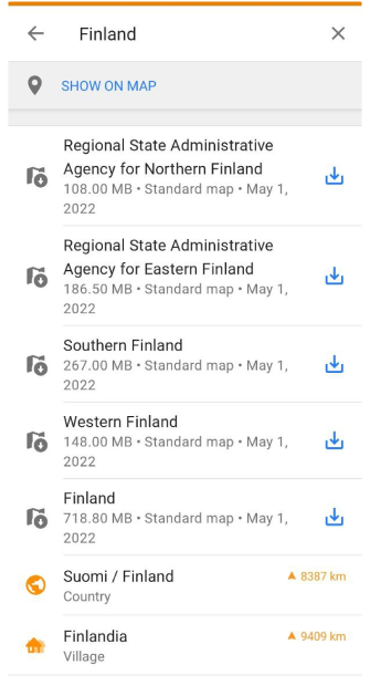
Download map redesign
Suggesting to download map in the Search menu.
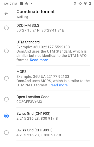
New Coordinate format
Added support for SwissGrid CH1903 / CH1903+ coordinates system, thanks to our co-author koenigle.
You can change the coordinate format for the profile in:
Menu → Settings → Configure profile → General settings → Coordinate format.
 | 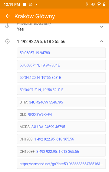 |
- Fixed UTM Zone: display UTM Zone coordinates as 31T instead of 31N.
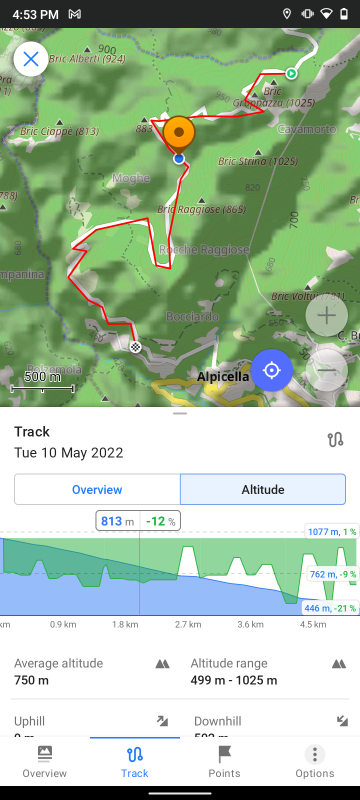
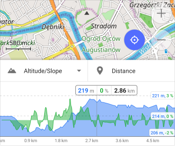
New Track Graph
- Analyze on the map: show data from two axes and UI.
- Aligned graph lines.
New parameter for "Route line appearance"
Added the option to display or hide turn arrows in the Route line settings.
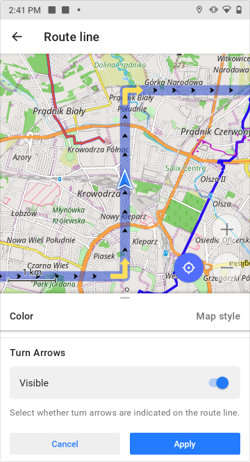 | 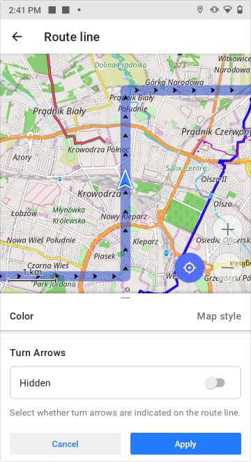 |
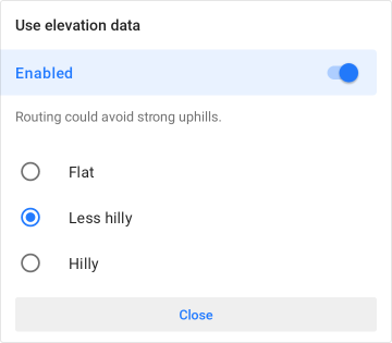
Modified "Use elevation data"
Three options have been added to the Use elevation data option, allowing you to set the preferred terrain of the route: flat, less hilly and hilly. Previously, this option was available only for Bicycle navigation.
Fixed
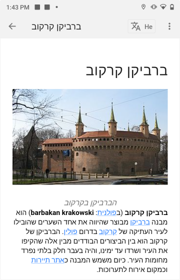
- Hebrew Wikipedia - images for Wikipedia articles are visible again.
Follow OsmAnd on Facebook, TikTok, Twitter, Reddit, and Instagram!
Join us at our groups of Telegram (OsmAnd News channel), (EN), (IT), (FR), (DE), (UA), (ES), (BR-PT), (PL), (AR), (TR).

